

✨ Enhancement Points
Mapping Accuracy and Detail
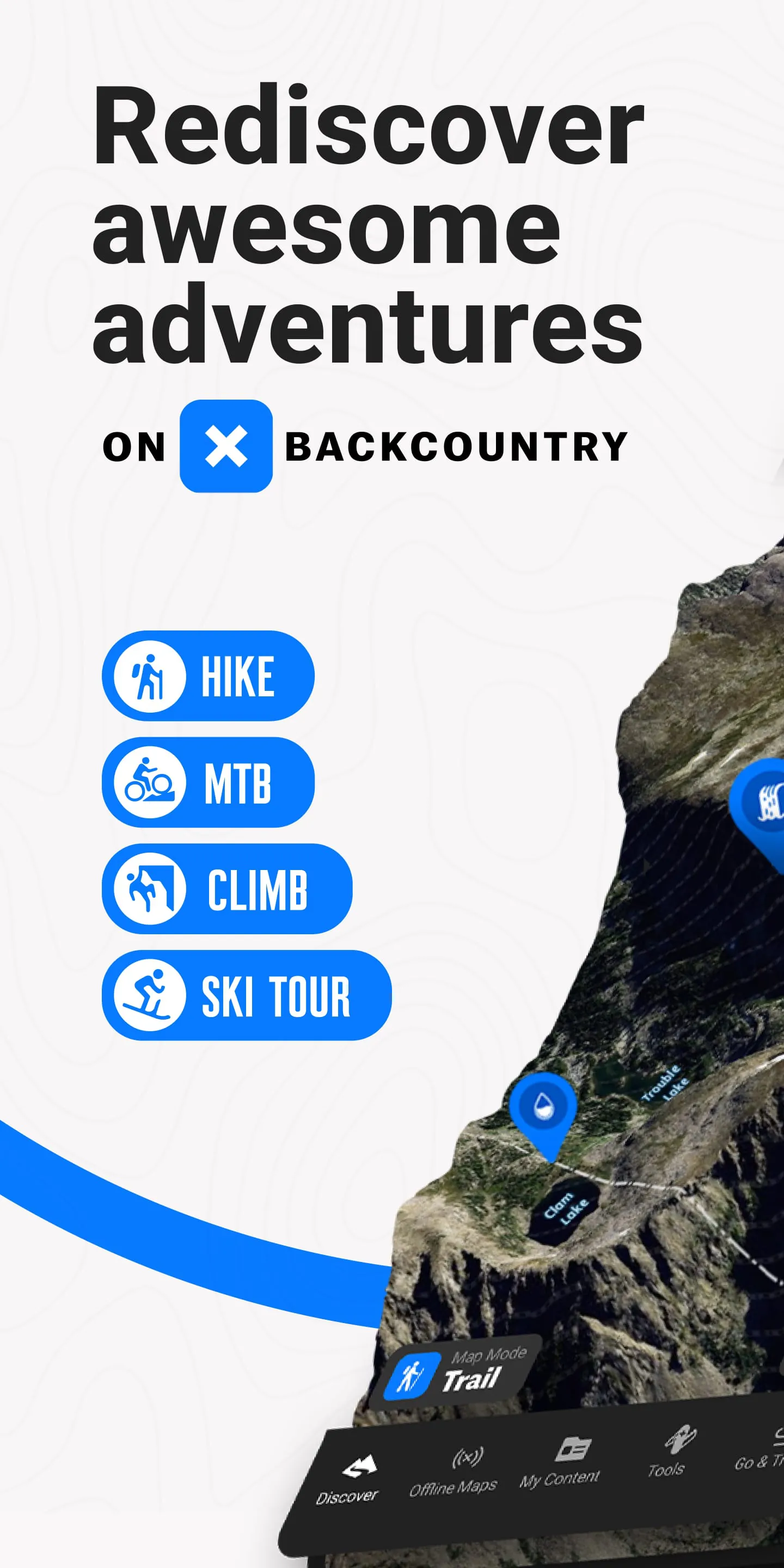
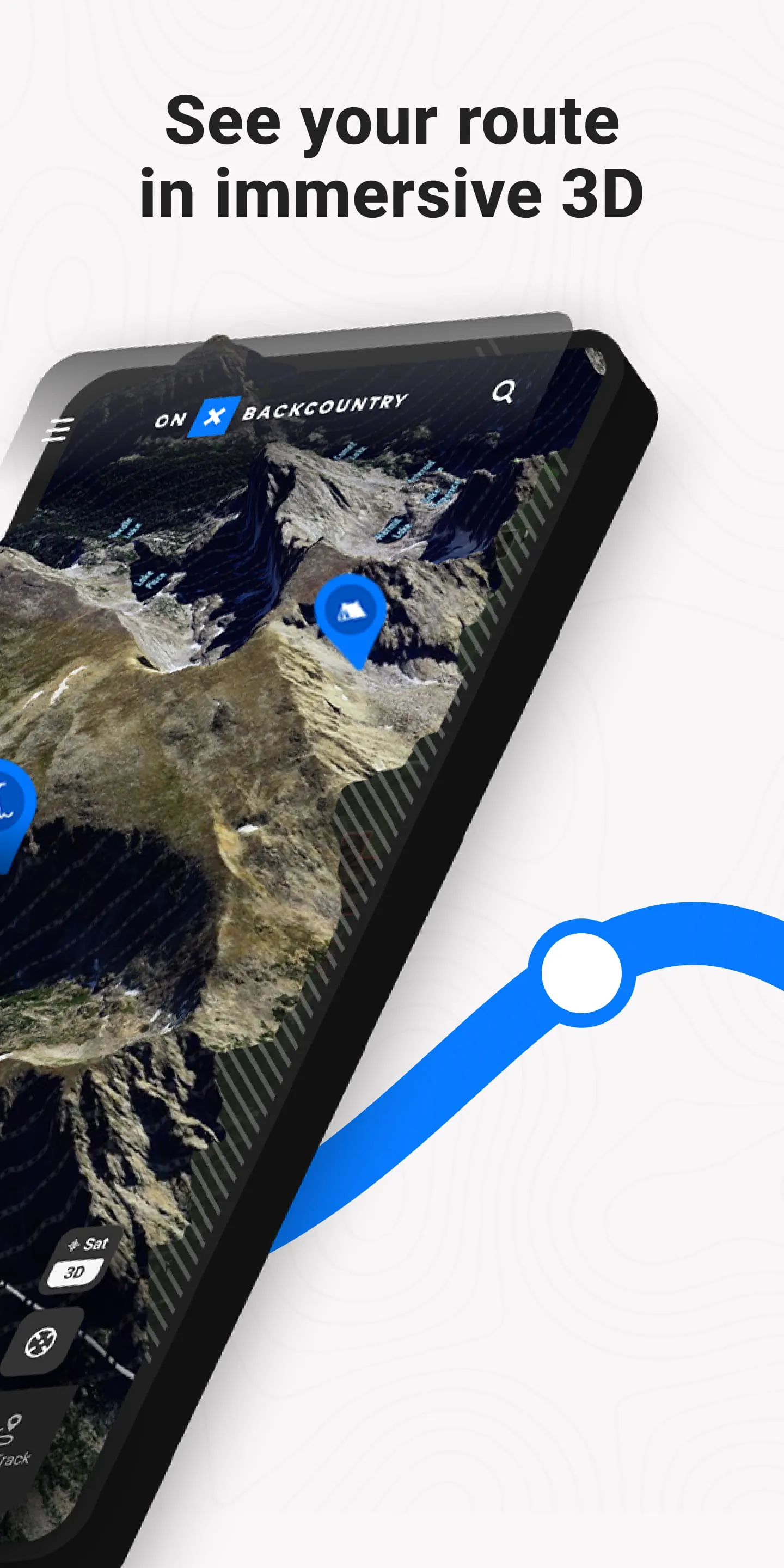
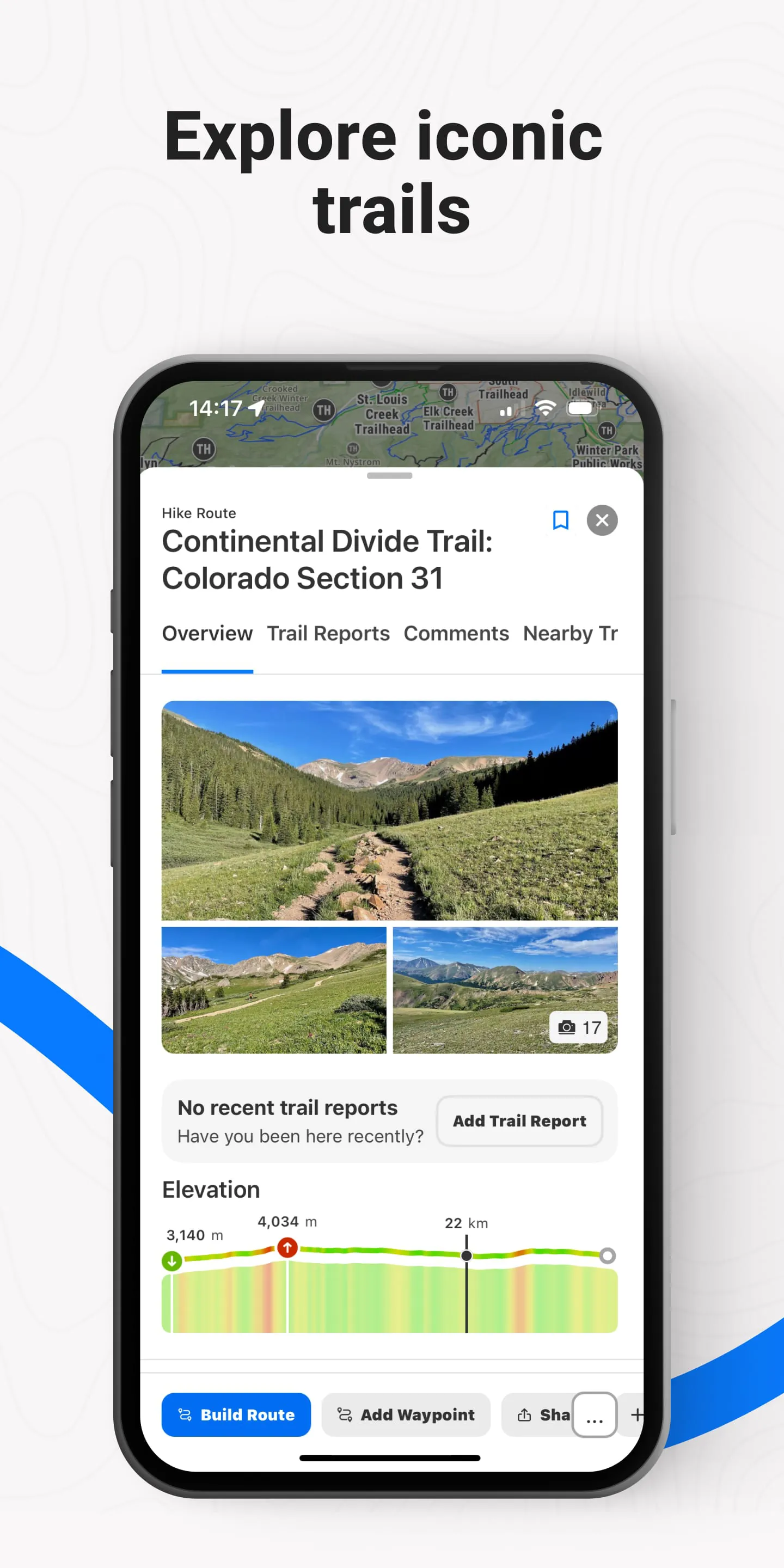
The application excels in providing highly detailed topographic maps, enhancing the user's ability to navigate complex terrain. The precision of the mapping data contributes significantly to user safety and confidence during backcountry excursions.
High-resolution imagery
further assists in identifying landmarks and planning routes effectively.
Offline Functionality
Offline map availability is a crucial enhancement. Users can download maps for areas with limited or no cellular service, ensuring continuous navigation capabilities. This feature elevates the app's reliability and makes it an essential tool for remote adventures. The efficiency of offline storage and retrieval directly impacts user experience.
📍 Improvement Areas
Battery Consumption
High battery drain during prolonged use is a noted concern. Optimizing the application's background processes and GPS usage could significantly improve battery life, making it more suitable for extended trips.
Power-saving modes and options for reduced GPS frequency would be valuable upgrades.
User Interface
While functional, the user interface could benefit from a more intuitive design. Streamlining the map downloading process, improving search functionality, and enhancing overall visual clarity would contribute to a more user-friendly experience.
Simplifying the layering of map data
can also improve accessibility.
🚀 Upgrade Elements
Augmented Reality Integration
Integrating augmented reality (AR) features could dramatically enhance the navigation experience. Allowing users to overlay digital information onto their real-world view would provide an innovative and immersive way to explore the backcountry. AR enhancements would further differentiate the app from its competitors.
📊 Value Additions
Integration with Wearable Devices
Seamless integration with wearable devices, such as smartwatches, would provide users with convenient access to navigation data directly on their wrists. This upgrade element enhances accessibility and allows for hands-free operation, increasing user convenience and safety during activities. The compatibility with various wearable platforms amplifies its value.
Enhanced Weather Forecasting
Implementing more precise and localized weather forecasting within the app adds significant value. Integration with hyperlocal weather data sources and predictive algorithms can provide users with crucial information for trip planning and safety. Real-time updates and push notifications regarding changing weather conditions could be life-saving.
⭐ Overall Elevation Value
Reliability and Accessibility
By addressing the identified improvement areas and incorporating upgrade elements, the application can further solidify its position as a premier backcountry navigation tool. Enhancing reliability through battery optimization and improving accessibility through UI enhancements will significantly elevate its overall value to users.
Focusing on user-centric design and innovative features will drive long-term success.
Mapping Accuracy and Detail
The application excels in providing highly detailed topographic maps, enhancing the user's ability to navigate complex terrain. The precision of the mapping data contributes significantly to user safety and confidence during backcountry excursions. High-resolution imagery further assists in identifying landmarks and planning routes effectively.
Offline Functionality
Offline map availability is a crucial enhancement. Users can download maps for areas with limited or no cellular service, ensuring continuous navigation capabilities. This feature elevates the app's reliability and makes it an essential tool for remote adventures. The efficiency of offline storage and retrieval directly impacts user experience.
Battery Consumption
High battery drain during prolonged use is a noted concern. Optimizing the application's background processes and GPS usage could significantly improve battery life, making it more suitable for extended trips. Power-saving modes and options for reduced GPS frequency would be valuable upgrades.
User Interface
While functional, the user interface could benefit from a more intuitive design. Streamlining the map downloading process, improving search functionality, and enhancing overall visual clarity would contribute to a more user-friendly experience. Simplifying the layering of map data can also improve accessibility.
🚀 Upgrade Elements
Augmented Reality Integration
Integrating augmented reality (AR) features could dramatically enhance the navigation experience. Allowing users to overlay digital information onto their real-world view would provide an innovative and immersive way to explore the backcountry. AR enhancements would further differentiate the app from its competitors.
📊 Value Additions
Integration with Wearable Devices
Seamless integration with wearable devices, such as smartwatches, would provide users with convenient access to navigation data directly on their wrists. This upgrade element enhances accessibility and allows for hands-free operation, increasing user convenience and safety during activities. The compatibility with various wearable platforms amplifies its value.
Enhanced Weather Forecasting
Implementing more precise and localized weather forecasting within the app adds significant value. Integration with hyperlocal weather data sources and predictive algorithms can provide users with crucial information for trip planning and safety. Real-time updates and push notifications regarding changing weather conditions could be life-saving.
⭐ Overall Elevation Value
Reliability and Accessibility
By addressing the identified improvement areas and incorporating upgrade elements, the application can further solidify its position as a premier backcountry navigation tool. Enhancing reliability through battery optimization and improving accessibility through UI enhancements will significantly elevate its overall value to users.
Focusing on user-centric design and innovative features will drive long-term success.
Augmented Reality Integration
Integrating augmented reality (AR) features could dramatically enhance the navigation experience. Allowing users to overlay digital information onto their real-world view would provide an innovative and immersive way to explore the backcountry. AR enhancements would further differentiate the app from its competitors.
Integration with Wearable Devices
Seamless integration with wearable devices, such as smartwatches, would provide users with convenient access to navigation data directly on their wrists. This upgrade element enhances accessibility and allows for hands-free operation, increasing user convenience and safety during activities. The compatibility with various wearable platforms amplifies its value.
Enhanced Weather Forecasting
Implementing more precise and localized weather forecasting within the app adds significant value. Integration with hyperlocal weather data sources and predictive algorithms can provide users with crucial information for trip planning and safety. Real-time updates and push notifications regarding changing weather conditions could be life-saving.
⭐ Overall Elevation Value
Reliability and Accessibility
By addressing the identified improvement areas and incorporating upgrade elements, the application can further solidify its position as a premier backcountry navigation tool. Enhancing reliability through battery optimization and improving accessibility through UI enhancements will significantly elevate its overall value to users.
Focusing on user-centric design and innovative features will drive long-term success.